Stop guessing
where your pipes are
Record exact pipe locations and depth during installation. Know exactly where to dig years later.
What do I need?
HAL Asset Locator App
Cloud-based software for mapping and documenting underground infrastructure. Capture, visualize, and manage geo-referenced data with sub-inch accuracy.
High-Precision Geolocation Kit
The Emlid Reach RX is a compact, handheld GNSS receiver that delivers sub-inch positioning accuracy. It connects wirelessly to your iPhone via Bluetooth and receives signals from multiple satellite constellations.
iPhone with LiDAR
You'll also need an iPhone with LiDAR technology, available on iPhone 13 Pro and Pro Max, and new Pro and Pro Max models. LiDAR allows the app to capture depth and spatial data accurately for precise asset positioning.
What do you get from day one?
Infrastructure Protection
Sub-inch AccuracyPrevent costly damage to underground utilities with accurate pre-excavation mapping and verification.
Grade Comparison
Utility depth trackingDepth verification on every visit — Know the exact depth even if ground levels have changed over time. Never dig blind again.
Digital Documentation
Cloud-BasedView all your assets, add attributes, and navigate your entire network with interactive maps. Create records with custom attributes, photos, and exportable reports.
Correction Service
Eliminate GPS ErrorsReal-time RTK advanced corrections built into every plan, valued at $150 per month.
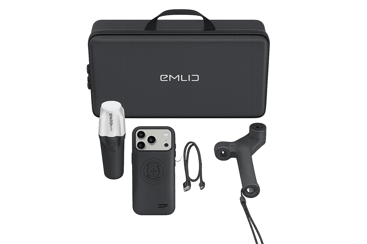
Everything you need to start mapping.
We've curated the HAL kit to be a turn-key solution. No extra sensors or complicated hardware sourcing required.
Reach RX
Multi-band GNSS receiver for sub-inch precision.
Emlid Handle
Secure, adjustable grip for your iPhone LiDAR device.
Leash
USB-C charging cables and 12-hour external battery.
SP Connect Case
Secure, adjustable grip for your iPhone LiDAR device.
Lifetime ownership • No recurring fees
Already have a Reach RX?
If you already own an Emlid Reach RX receiver, our team can help you verify compatibility and get you set up with the HAL app.
Compatibility Check
No Verification Fee
Guided Support
Our team will confirm your device is compatible before enabling app access at no charge.
Choose your plan
Flexible options to fit your business needs
Included in all plans
Give your team a complete platform to capture, manage, and relocate underground assets with confidence. HAL helps streamline field operations and improve data accuracy from capture to final deliverables.
Frequently Asked Questions
Standard smartphone GPS is only accurate to 5–16 feet. The Emlid Reach RX achieves centimeter-level accuracy (1–3 cm)—essential for knowing exactly where your buried assets are located. The kit connects to your iPhone via Bluetooth and works seamlessly with our app. No surveying experience required.
Currently, HAL Asset Locator integrates exclusively with the Emlid Reach RX. We chose this approach to ensure the app remains simple and reliable, even for users with no geolocation experience. We plan to add support for additional devices in the future.
The app requires an iPhone with LiDAR. Supported models:
- iPhone 12 Pro / Pro Max
- iPhone 13 Pro / Pro Max
- iPhone 14 Pro / Pro Max
- iPhone 15 Pro / Pro Max
- iPhone 16 Pro / Pro Max
- iPhone 17 Pro / Pro Max
No additional subscription required. Your account includes the Advanced Correction Service (valued at $150/month), which provides:
- 1–3 cm horizontal and vertical accuracy
- Immediate fix time
- Coverage across US, UK, EU, South Korea, Australia, New Zealand, and Japan